Bailey Trail Trek
- Overview
- Itinerary
- Map
- Pictures
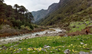
“Bailey Trail” trek traces the historic route taken by Lt. Col. F M Bailey and Capt. H T Morshed, British officers who were commissioned to survey the lands between Arunachal Pradesh and Tibet during 1911-12. The trek was initially an ancient trade route that connected Burma, India and Tibet. In 1962 the Chinese army used this route to strike deep into Arunachal Pradesh. The ‘Bailey Trail’ as it is known now, crosses through some pristine remote forests of the Eastern Himalayas, where pine, oak and rhododendrons grow aplenty.
Throughout the trek, the presence of breathtaking landscapes will overwhelm you, and at times, you’ll be able to see the majestic peaks of Gorichen and Kangto, two of northeastern India’s highest peaks. The highest point of this trek will be Sela Pass at a height of 4550 m. Entirely, you’ll be crossing high mountain passes, glacial rivers, crystal clear lakes, villages of the Monpa Tribe, and will be staying at campsites that will awe you. And as a bonus, you’ll be visiting the Buddhist hill station of Tawang where the second largest Buddhist monastery of Asia is magnificently located.
No details found.


